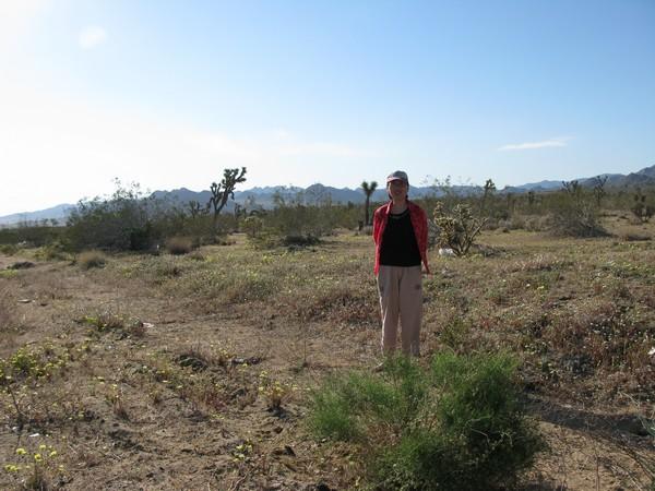


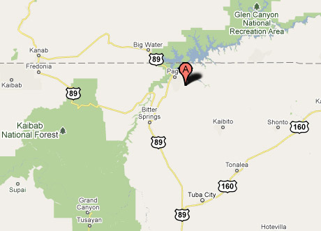
US:AZ - Antelope Canyon
Antelope Canyon - Northern Arizona
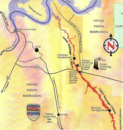
Antelope Canyon is the most-visited and most-photographed slot canyon in the American Southwest.[1] It is located on Navajo land near Page, Arizona. Antelope Canyon includes two separate, photogenic slot canyon sections, referred to individually as Upper Antelope Canyon or The Crack; and Lower Antelope Canyon or The Corkscrew. The Navajo name for Upper Antelope Canyon is Tse' bighanilini, which means "the place where water runs through rocks." Lower Antelope Canyon is Hasdestwazi, or "spiral rock arches." Both are located within the LeChee Chapter of the Navajo Nation.
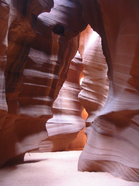
Antelope Canyon was formed by erosion of Navajo Sandstone,[2] primarily due to flash flooding and secondarily due to other sub-aerial processes. Rainwater, especially during monsoon season, runs into the extensive basin above the slot canyon sections, picking up speed and sand as it rushes into the narrow passageways. Over time the passageways are eroded away, making the corridors deeper and smoothing hard edges in such a way as to form characteristic 'flowing' shapes in the rock. Flooding in the canyon still occurs. A flood occurred on October 30, 2006 that lasted 36 hours, and caused the Tribal Park Authorities to close Lower Antelope Canyon for five months.
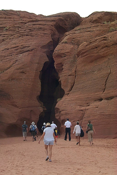
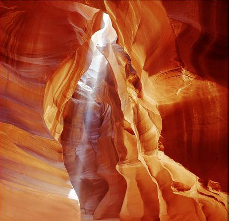
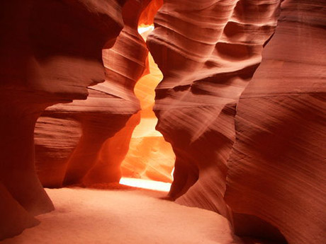
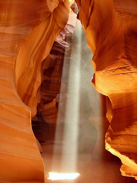
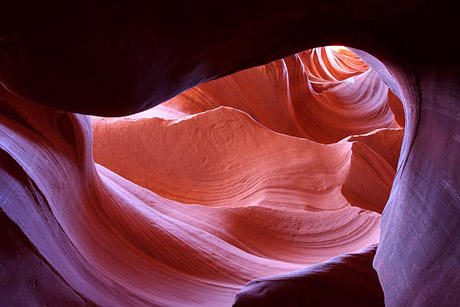
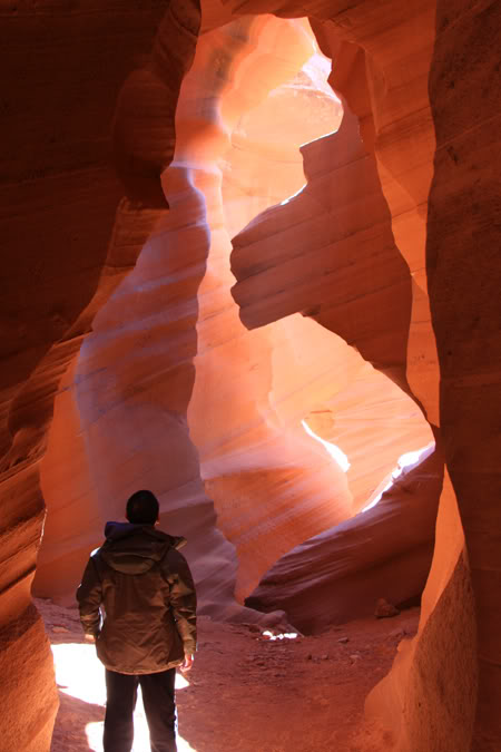
Upper Antelope Canyon Upper Antelope Canyon, called Tse bighanilini, "the place where water runs through rocks" by the Navajo, is located at 36°51′28″N 111°22′20″W / 36.85778°N 111.37222°W / 36.85778; -111.37222Coordinates: 36°51′28″N 111°22′20″W / 36.85778°N 111.37222°W / 36.85778; -111.37222. It is the most frequently visited by tourists, due to two considerations. First, its entrance and entire length are at ground level, requiring no climbing. Second, beams (shafts of direct sunlight radiating down from openings in the top of the canyon) are much more common in Upper than in Lower. Beams occur most often in the summer months, as they require the sun to be high in the sky. Winter colors are a little more muted like the photo displayed here. Summer months provide two types of lighting. Light beams start to peek into the canyon March 15 and disappear October 7 each year.
Lower Antelope Canyon, called Hasdeztwazi, or "spiral rock arches" by the Navajo, is located a few kilometers away. Prior to the installation of metal stairways, visiting the canyon required climbing along pre-installed ladders in certain areas. Even following the installation of stairways, it is a more difficult hike than Upper Antelope—it is longer, narrower in spots, and even footing is not available in all areas. At the end, the climb out requires several flights of stairs. Despite these limitations, Lower Antelope Canyon draws a considerable number of photographers, though casual sightseers are much less common there than in Upper. The lower canyon is in the shape of a "V" and shallower than the Upper Antelope. Lighting is better in the early hours and late afternoon.
Entry to Antelope Canyon is restricted to guided tours led by authorized guides. The park website[8] has a list of guides.
As of July 2008, guided tours of Upper Antelope Canyon are reported to cost $32 USD which includes Navajo Park Permit of $6, and Lower Antelope Canyon $20 per person.